True
Space Available For Lease 1
352 E US HWY 60 |
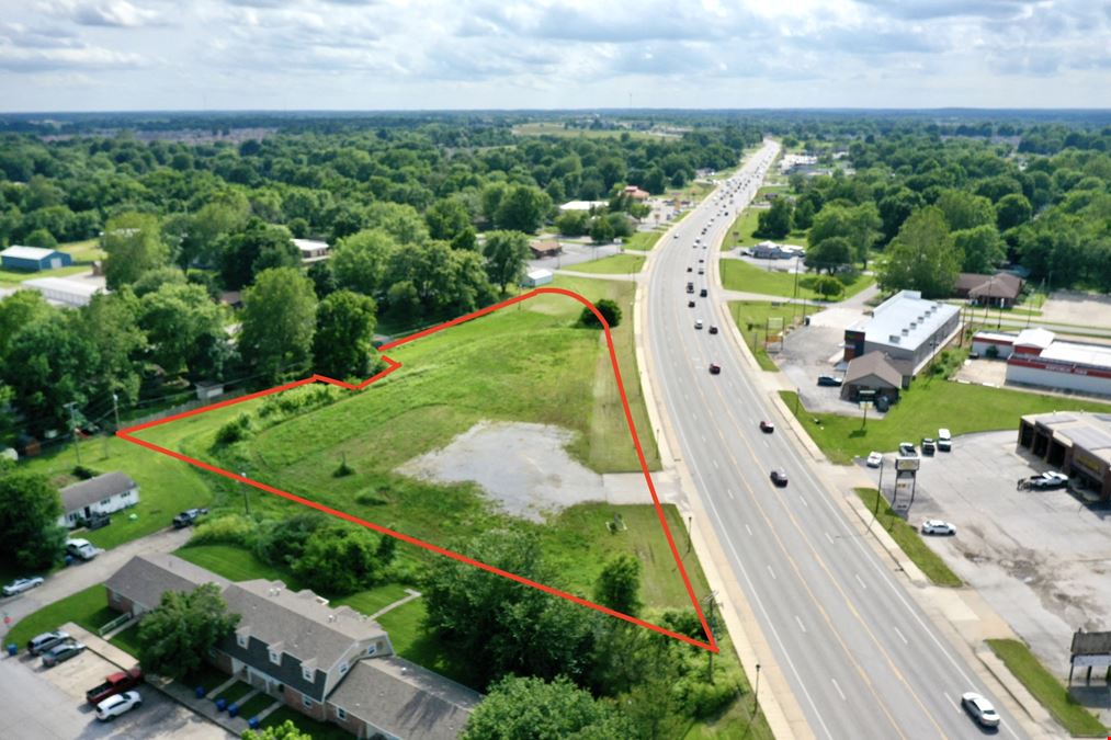
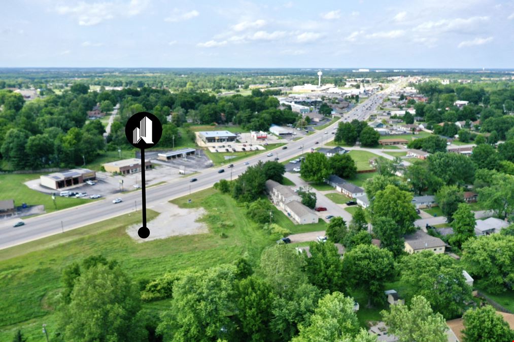
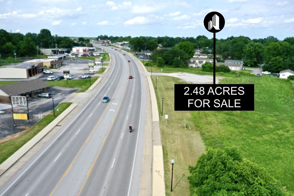
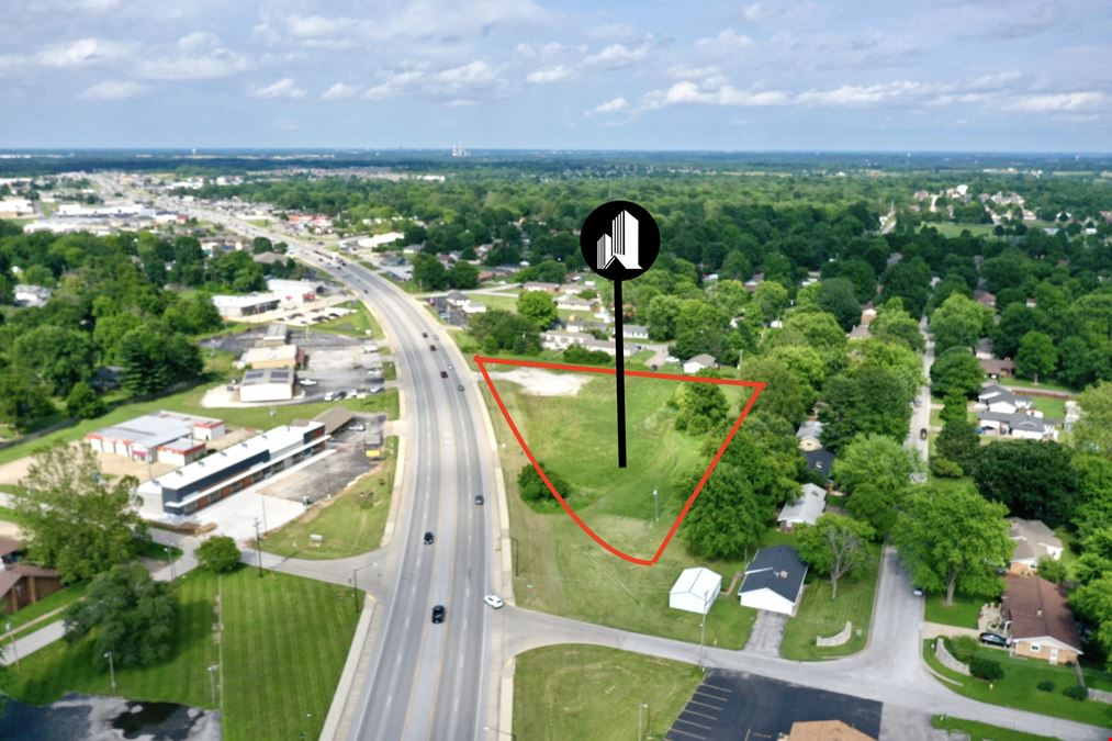
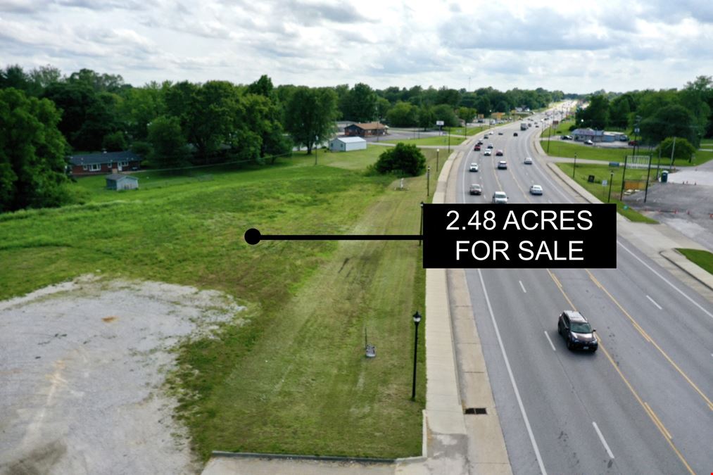
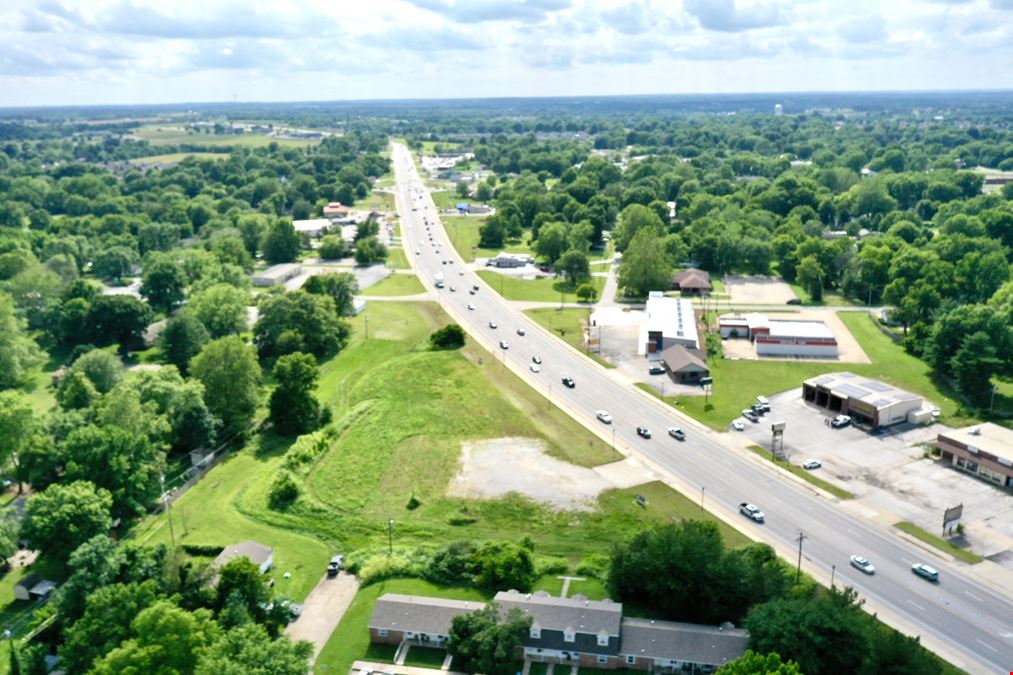
Thank you for looking at the 2.48 acre lot FOR LEASE on US HWY 60 in Republic, MO. Development opportunity for Retail / Office. Zoned General Commercial. 2023 Tax $3,108.53. 665' Highway frontage. For Sale at $1,350,000 For Lease at $8,500 per month NNN. Please contact the Listing Agent for details. 
Gerald Zamora
Zamora Real Estate |
Contacts

Zamora Real Estate
Property Details
- Property Type VacantLand
- Lot Size 2.48 Acre
- Additional Rent Contact for pricing
- Date Updated Dec 5, 2024
Reach out to the broker for more info on lease terms and amenities
Attachments
Getting around
-
32/100
Walk Score ®
-
38/100
Bike Score ®
Location
- City Republic, MO
- Neighborhood Republic
- Zip Code 65738
Points of Interest
-
Next Stop
0.34 miles
-
Kum & Go
0.97 miles
-
Casey's
1.00 miles
-
Murphy USA
1.69 miles
-
Conoco (Cars)
1.95 miles
-
Conoco (Trucks)
1.95 miles
-
Shell
2.09 miles
-
Kum & Go (Trucks)
3.78 miles
-
Kum & Go (Cars)
3.83 miles
-
Conoco
6.37 miles
-
8. Route of Union Advance & Withrawal (Parallel Parking)
3.71 miles
-
7. Bloody Hill and Totten's Battery
3.83 miles
-
6. Guibor's Battery (Parallel Parking)
3.90 miles
-
5. Sigel's Final Position and Sharp Farm site
4.29 miles
-
1. Gibson's House and Mill
4.38 miles
-
3. East Battlefield Overlook
4.50 miles
-
4. Sigel's Second Position and Sharp farm fields
4.56 miles
-
Horse Trailer Parking
4.67 miles
-
2. Ray Farm
4.78 miles
-
AmericInn by Wyndham Republic
1.65 miles
-
Quality Inn & Suites
9.21 miles
-
Value Place Springfield
9.22 miles
-
Best Western Plus Springfield Airport Inn
9.36 miles
-
Best Budget Inn Springfield-Magnuson
9.40 miles
-
Price Cutter
1.45 miles
-
Walmart Supercenter
1.81 miles
-
ALDI
2.08 miles
-
Apple Market
5.23 miles
-
Walmart Neighborhood Market
7.99 miles
-
Burlington
8.51 miles
-
Ross
8.57 miles
-
Hy-Vee
9.89 miles
Access more in-depth information about this property — including ownership, tenant details, property characteristics and transaction history, along with local market insights and much more — on CommercialEdge.

Zamora Real Estate
